
Line 4 Info
- Network Madrid Metro
- Operation Started 1944
- Total Length 16.0 km
- Total Stations 23
Terminals
From
Pinar de Chamartín
To
Argüelles
Line 4 Overview
Line 4 opened on March 23, 1944, and was built in several phases. Initially, it ran between Arguelles and Goya, then in 1958, the Goya-Diego de León branch from Line 2 was incorporated. It was later extended eastward to Alfonso XIII in 1973, to Esperanza in 1979, and to Mar de Cristal and Parque de Santa María in 1998. The newest extension, from Parque de Santa María to Pinar de Chamartín, opened on April 11, 2007. The line is 16 kilometers long and has 23 stations. It also offers interchanges at several stations with Madrid Metro Lines 1, 2, 3, 5, 6, 7, 8, 9, 10, and Metro Ligero Line 1.
Madrid Metro Map 2026
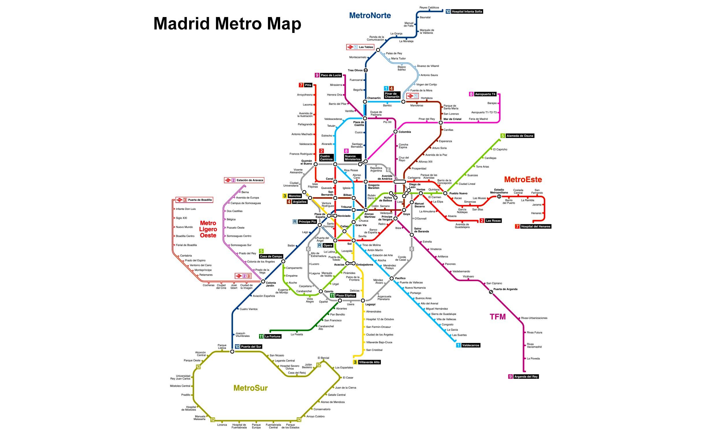
Click to expand
Other Lines in Madrid Metro
Line 1
Pinar de Chamartín ↔ Valdecarros
33 stations
Line 10
Hospital Infanta Sofía ↔ Puerta del Sur
31 stations
Line 11
Plaza Elíptica ↔ La Fortuna
7 stations
Line 12
Puerta del Sur ↔ San Nicasio
28 stations
Line 2
Cuatro Caminos ↔ Las Rosas
20 stations
Line 3
Villaverde Alto ↔ Moncloa
18 stations
Line 5
Alameda de Osuna ↔ Casa de Campo
32 stations
Line 6
Laguna ↔ Lucero
28 stations
Line 7
Hospital del Henares ↔ Pitis
31 stations
Line 8
Aeropuerto T4 ↔ Nuevos Ministerios
8 stations
Line 9
Paco de Lucía ↔ Arganda del Rey
29 stations
ML Line 1
Pinar de Chamartín ↔ Las Tablas
9 stations
Frequently Asked Questions — Line 4
Line 4 has 23 stations on the Madrid Metro network.
Line 4 runs between Pinar de Chamartín and Argüelles.
Line 4 is approximately 16.0 km long.
Line 4 opened in 1944.
Line 4 is a Metro line operated under Madrid Metro.
Line 4 is part of the Madrid Metro transit network.