Route Finder

City Hall to Clarke Quay Route

3 stations1 interchange2.1 km~4 min
Board North–South Line towards Marina South Pier
Change to North East Line towards Punggol
  1. 1
    Start at City Hall station.
  2. 2
    Board the North–South Line towards Marina South Pier
    Ride 1 stop to Dhoby Ghaut.
    Change lines here
  3. 3
    Board the North East Line towards Punggol
    Ride 1 stop to Clarke Quay.
  4. Arrive at Clarke Quay station. You have reached your destination.
Origin

City Hall Singapore

Gates / Exits

Gate A City Hall / Stamford Road
Gate B Raffles City / North Bridge Road
Gate C Suntec City / Esplanade
Gate D Peninsula Plaza / Coleman Street
Destination

Clarke Quay Singapore

Gates / Exits

Gate A Clarke Quay Central / River Valley Road
Gate B Singapore River / Riverside Point
Gate C The Central / Eu Tong Sen Street
Gate D Hong Lim Park / Upper Circular Road

More routes from City Hall

More routes from Clarke Quay

City Hall to Clarke Quay — Frequently Asked Questions

There are 3 stations on the route from City Hall to Clarke Quay, including the origin and destination.

You need to make 1 interchange to travel from City Hall to Clarke Quay, using North–South Line and North East Line.

The distance from City Hall to Clarke Quay is approximately 2.1 km by MRT.

The estimated journey time from City Hall to Clarke Quay is approximately 4 minutes.

You can travel from City Hall to Clarke Quay via North–South Line and North East Line on the Singapore MRT.

To travel in the reverse direction from Clarke Quay to City Hall, follow the same route in the opposite direction. The journey takes approximately 4 minutes.

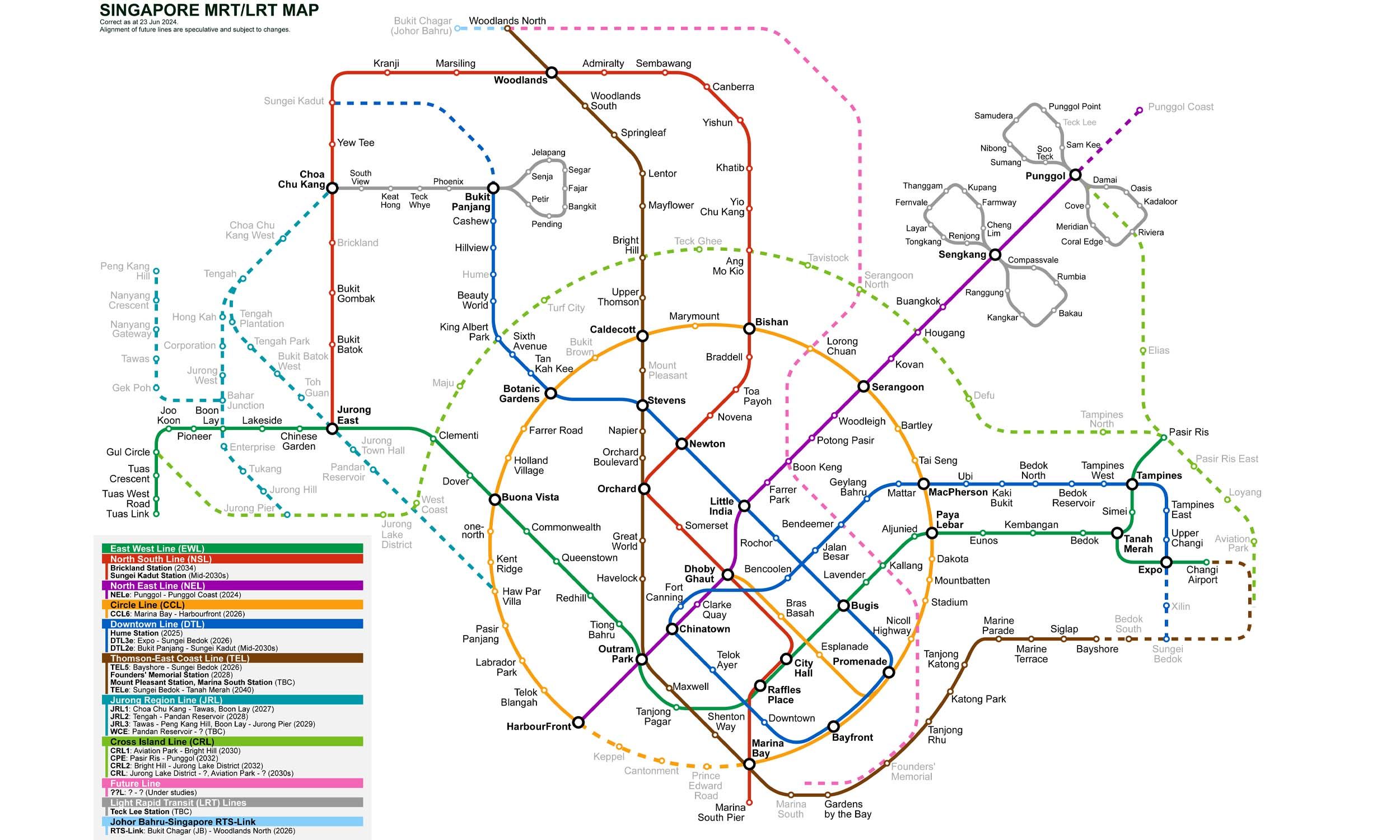
Singapore MRT Map 2026

Singapore MRT map
Click to expand