
StuyvenberghBrussels
Metro Lines
Stuyvenbergh Station Location on Map
Houba De Strooperlaan, 1020 Laeken, City of Brussels, Brussels-Capital Region, Belgium


Stuyvenbergh Station Overview
Stuyvenberg is an underground metro station on Line 6 of the Brussels Metro. It is in the Laeken district, northwest of the city of Brussels, Belgium. It is the 4th station on Line 6 from Roi Baudouin station and the 23rd station from Élisabeth station.
Lines at Stuyvenbergh Station
Line 6
Brussels Metro
Towards: Koning Boudewijn
Previous: Houba-Brugmann
0.6 km
Platform No.: Island
First Train: 6:20 AM Last Train: 12:26 AM
Towards: Simonis
0.8 km
Next: Bockstael
Platform No.: Island
First Train: 5:33 AM Last Train: 12:23 AM
Underground
Stuyvenbergh Station Info
- Opened 1985
- Coordinates 50.88638, 4.34137
-
Lines
1
Brussels Metro Map 2026
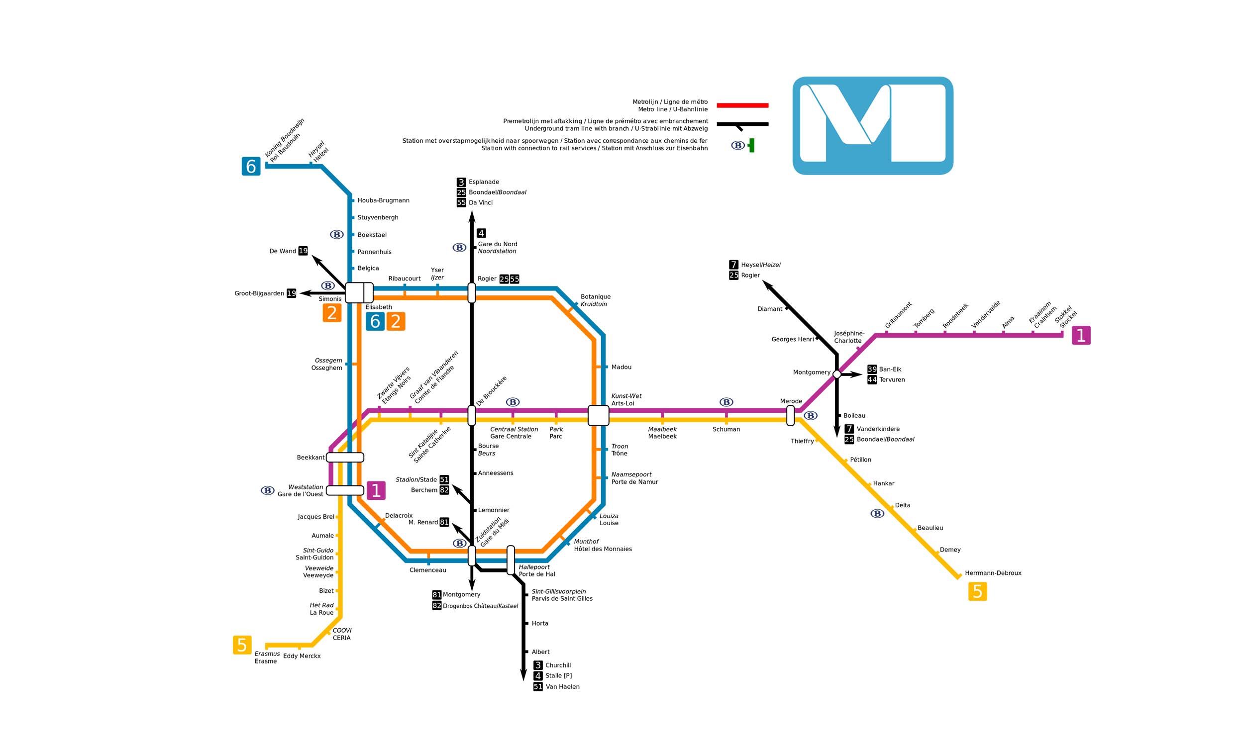
Click to expand
Gates (4)
-
Gate 1 Avenue Houba de Strooper (Houba de Strooperlaan)
-
Gate 2 Avenue Houba de Strooper (Houba de Strooperlaan)
-
Gate 3 Avenue Houba de Strooper (Houba de Strooperlaan)
-
Gate 4 Avenue Houba de Strooper (Houba de Strooperlaan)
Other Stations in Brussels Metro
59Frequently Asked Questions — Stuyvenbergh Station
Stuyvenbergh station is served by 1 line: Line 6.
Stuyvenbergh station is part of the Brussels Metro network in Brussels.
Stuyvenbergh station has 4 gates.
Stuyvenbergh station opened in 1985.
Stuyvenbergh station is located at coordinates 50.88638, 4.34137 in Brussels.
You can reach Stuyvenbergh station via the Brussels Metro. Use the route finder on this page to plan your journey from any station.