Roodebeek Metro StationBrussels
Metro Lines
Roodebeek Metro Station Location on Map
Paul Hymanslaan, 1200 Woluwe-Saint-Lambert, Brussels-Capital Region, Belgium


Roodebeek Metro Station Overview
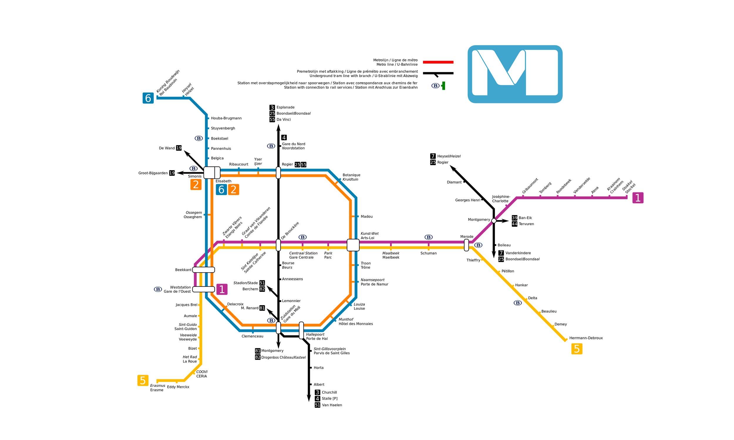
Roodebeek is an underground metro station on Line 1 of the Brussels Metro. It is located in the Woluwe-Saint-Lambert municipality in eastern Brussels. The station serves the Woluwe shopping centre and a bus interchange. It takes its name from the nearby Roodebeek Park. The station is the 17th station on Line 1 from West Station and the 5th from Stokkel.
Lines at Roodebeek Metro Station
Line 1
Brussels MetroRoodebeek Metro Station Info
- Opened 1982
- Coordinates 50.84757, 4.43571
-
Lines
1
Brussels Metro Map 2026
Click to expand
Gates (6)
-
Gate 1 Avenue Jacques Brel (Jacques Brellaan)
-
Gate 2 Place du Temps Libre (Vrijetijdsplein)
-
Gate 3 Cours Paul-Henri Spaak (Paul-Henri Spaak Promenade)
-
Gate 5 Avenue Paul Hymans (Paul Hymanslaan)
-
Gate 6 Avenue Paul Hymans (Paul Hymanslaan)
-
Gate 0 (Lift exit) Avenue Jacques Brel (Jacques Brellaan)
Other Stations in Brussels Metro
59Frequently Asked Questions — Roodebeek Station
Roodebeek station is served by 1 line: Line 1.
Roodebeek station is part of the Brussels Metro network in Brussels.
Roodebeek station has 6 gates.
Roodebeek station opened in 1982.
Roodebeek station is located at coordinates 50.84757, 4.43571 in Brussels.
You can reach Roodebeek station via the Brussels Metro. Use the route finder on this page to plan your journey from any station.