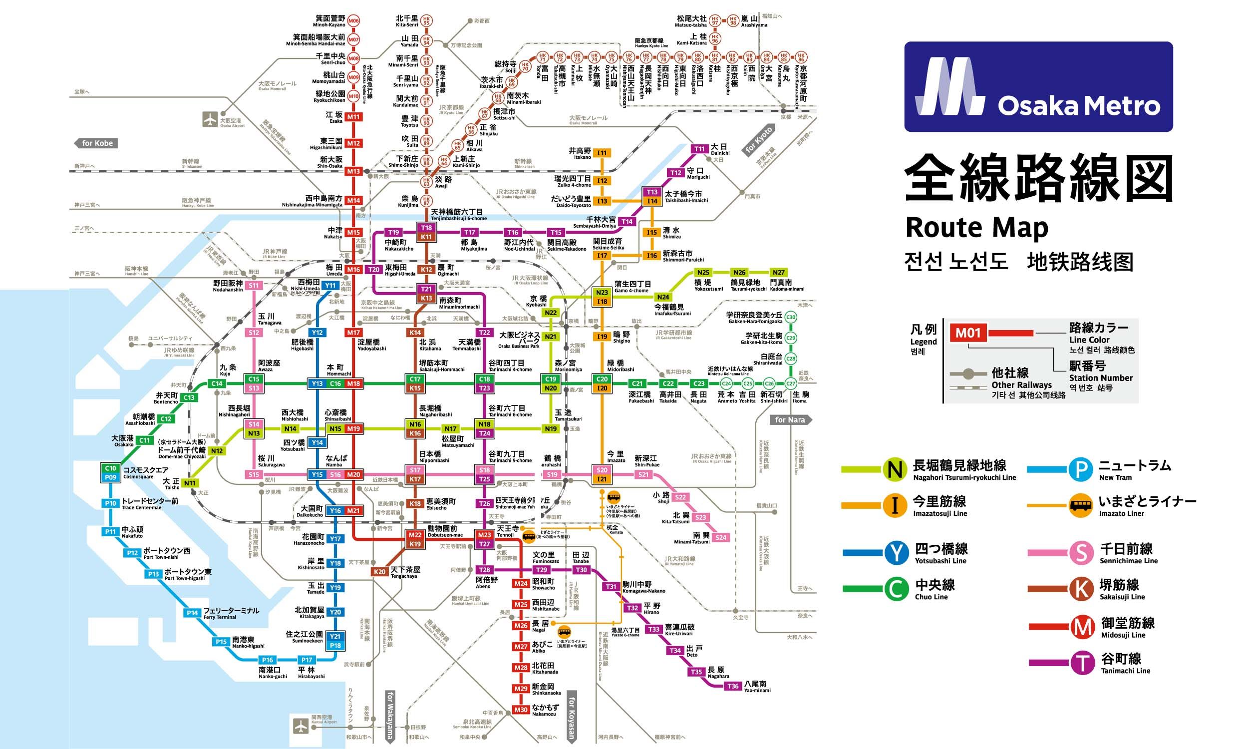
9 stations2 interchanges9.4 km~19 min
Board
Nagahori Tsurumi-ryokuchi Line
Platform 1
towards Kadoma-minami
Change to
Chūō Line (Yumehanna)
Platform 1
towards Takaida
Change to
Sennichimae Line
Platform 1
towards Minami-Tatsumi
- 1
-
2
Board the Nagahori Tsurumi-ryokuchi Line towards Kadoma-minami · from Platform 1
Ride 3 stops to Morinomiya.Change lines here -
3
Board the Chūō Line (Yumehanna) towards Takaida · from Platform 1
Ride 4 stops to Awaza.Change lines here -
4
Board the Sennichimae Line towards Minami-Tatsumi · from Platform 1
Ride 1 stop to Nishi-Nagahori.
Origin
Gamō-yonchōme Osaka
Gates / Exits
Gate No. 1
Gamo 4-chome intersection NW corner / Joto Ward Office / Joto Public Health and Welfare Center Annex / Joto Tax Office / Naniwahigashi Osaka Prefectural Tax Office / Joto Kaikan (Library) / Joto Children’s Center / Joto Police Station / Joto Fire Station / Welfare Center for the Aged / Joto Kumin Hall / NTT Joto / Japan Pension System Joto Office / Joto Pension Consultation Center / Chuo 1- to 3-chome
Gate No. 2
Gamo 4-chome intersection NE corner / Imafuku-nishi 3- & 5-chome / City Bus
Gate No. 3
Gamo 4-chome intersection SE corner / Imafuku-nishi 1-chome / City Bus
Gate No. 4
Gamo 4-chome intersection SW corner / Gamo 3- & 4-chome / City Bus
Gate No. 5
Osaka City Shinkin Bank / Osaka National Highway Office / Imafuku Children’s Center / Imafuku-nishi 1- to 4-chome / Imafuku-minami 1- & 2-chome / City Bus
Gate No. 6
National Route 1 east side / Imafuku-nishi 3- & 5-chome / City Bus
Gate No. 7
National Route 1 west side / Chuo 1- to 3-chome / Joto Ward Office / Joto Public Health and Welfare Center / Higashiosaka Hospital / Japan Pension Service Joto Branch Office / Joto library / City Bus
Destination
Nishi-Nagahori Osaka
Gates / Exits
Gate No. 1
Nagahori-dori north side / Shimmachi 2- & 3-chome / Itachibori 3- & 4-chome / City Bus
Gate No. 2
Nagahori-dori south side / Japan Pension Service Horie Branch Office / Kitahorie 2- & 3-chome / City Bus
Gate No. 3
Nagahori-dori south side / Tosa Inari-jinja Shrine / Nishi Ward Office / Nishi Health Center / Central Holiday Emergency Clinic / Kitahorie 4-chome / Shimmachi 4-chome / Itachibori 5-chome / City Bus
Gate No. 4A
Nagahori-dori north side / Nishi Ward Office / Nishi Public Health and Welfare Center / Central Holiday Emergency Clinic / NTT Shimmachi / Shimmachi 4-chome / Itachibori 5- & 6-chome / City Bus
Gate No. 4B
Connection to Bicycle Parking Lot
Gate No. 4C
Nagahori-dori north side / NTT Shimmachi / Shimmachi 4-chome
Gate No. 5
Connecting walkway to Miki Sangyo Bldg. / Amidaike / Kitahorie 2- & 3-chome / Minamihorie 2- & 3-chome
Gate No. 6
Connecting walkway to Miki Sangyo Bldg. / Amidaike / Kitahorie 2- & 3-chome / Minamihorie 2- & 3-chome
Gate No. 7A
Osaka Municipal Chuo Library / Kodomo Bunka Center / Nishi-ku Citizen’s Center / Osaka City Archives / Kitahorie 4-chome / Minamihorie 4-chome
Gate No. 7B
Osaka Municipal Chuo Library / Kodomo Bunka Center / Nishi-ku Citizen’s Center / Osaka City Archives / Kitahorie 4-chome / Minamihorie 4-chome