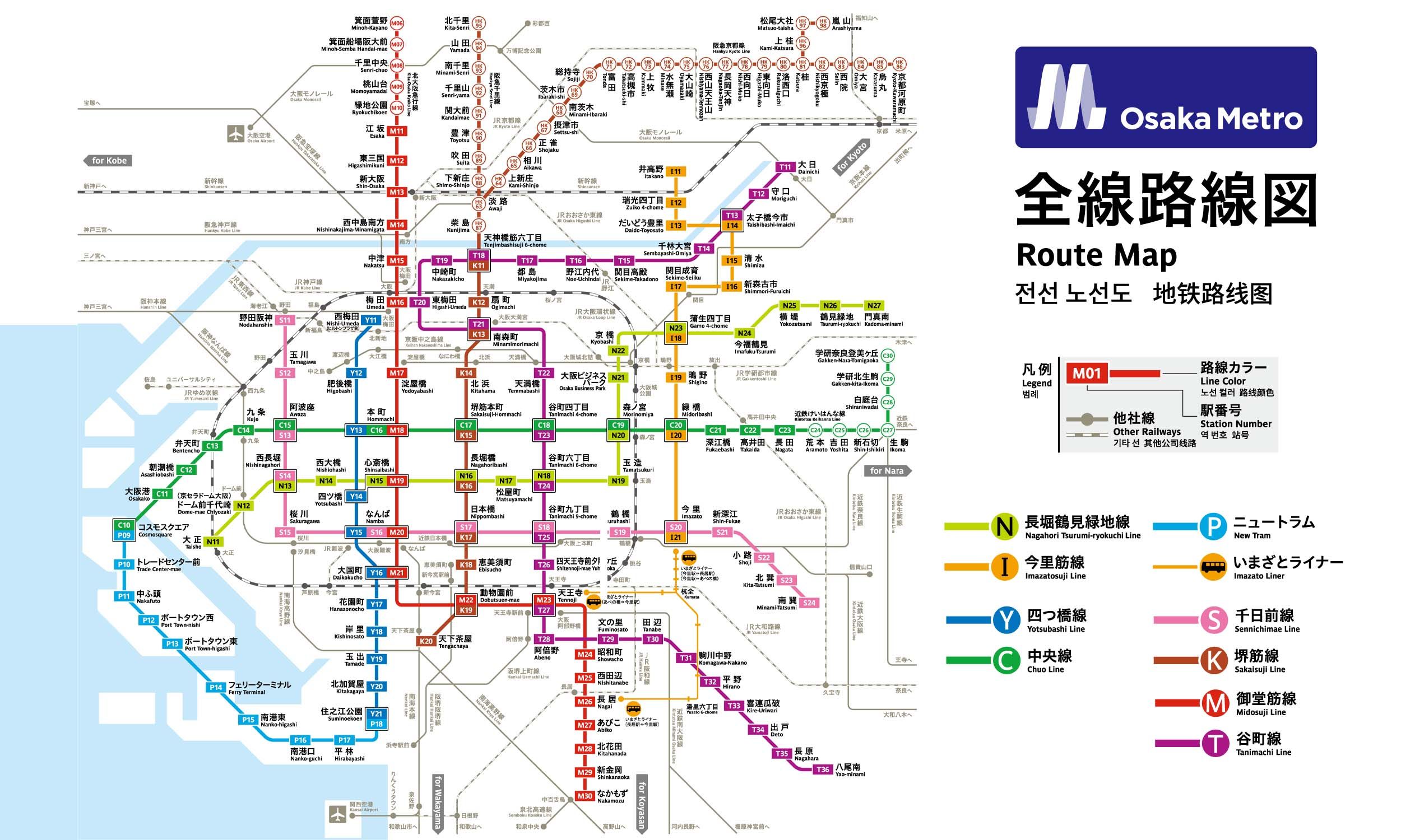
10 stations1 interchange9.8 km~20 min
Board
Imazatosuji Line
Platform 1
towards Imazato
Change to
Tanimachi Line
Platform 1
towards Yaominami
- 1
-
2
Board the Imazatosuji Line towards Imazato · from Platform 1
Ride 4 stops to Taishibashi-Imaichi.Change lines here -
3
Board the Tanimachi Line towards Yaominami · from Platform 1
Ride 5 stops to Tenjimbashisuji Rokuchōme.
Origin
Gamō Yonchōme Osaka
Gates / Exits
Gate No. 1
Gamo 4-chome intersection NW corner / Joto Ward Office / Joto Public Health and Welfare Center Annex / Joto Tax Office / Naniwahigashi Osaka Prefectural Tax Office / Joto Kaikan (Library) / Joto Children’s Center / Joto Police Station / Joto Fire Station / Welfare Center for the Aged / Joto Kumin Hall / NTT Joto / Japan Pension System Joto Office / Joto Pension Consultation Center / Chuo 1 to 3-chome
Gate No. 2
Gamo 4-chome intersection NE corner / Imafuku-nishi 3- & 5-chome / City Bus
Gate No. 3
Gamo 4-chome intersection SE corner / Imafuku-nishi 1-chome / City Bus
Gate No. 4
Gamo 4-chome intersection SW corner / Gamo 3- & 4-chome / City Bus
Gate No. 5
Osaka City Shinkin Bank / Osaka National Highway Office / Imafuku Children’s Center / Imafuku-nishi 1- to 4-chome / Imafuku-minami 1- & 2-chome / City Bus
Gate No. 6
National Route 1 east side / Imafuku-nishi 3- & 5-chome / City Bus
Gate No. 7
National Route 1 west side / Chuo 1 to 3-chome / Joto Ward Office / Joto Public Health and Welfare Center / Higashiosaka Hospital / Japan Pension Service Joto Office / Joto Library / City Bus
Destination
Tenjimbashisuji Rokuchōme Osaka
Gates / Exits
Gate No. 1
Miyakojima-dori south side / Kaneicho / Ikedacho / Hinokuchicho
Gate No. 2
Miyakojima-dori north side / Nagara-Kokubunji / Kokubunji 1- & 2-chome / Nagara-naka 1- & 2-chome / Nagara-higashi 1- & 2-chome
Gate No. 3
Tenjimbashi 6 intersection SE corner / Connecting walkway to Osaka Sumai Joho Center / Connecting walkway to Osaka Museum of Housing and Living / Connecting walkway to Osaka Municipal Housing Corporation / Connecting walkway to Childcare Iroiro Consultation Center / Connecting walkway to Sumitomo Mitsui Banking Corporation / Tenjimbashi 5- & 6- chome / Kaneicho / City Bus
Gate No. 4
Tenjimbashi 6 intersection NE corner / Tenjimbashi 7- & 8- chome
Gate No. 5
Kokubunji 1- & 2-chome / Nagara-nishi 1- & 2-chome / Nagara-naka 1- & 2-chome / City Bus
Gate No. 6
Tenjimbashi 6 intersection NE corner / Tenjimbashi 7- & 8- chome / City Bus
Gate No. 8
Tenjimbashi 6 intersection SE corner / Tenjimbashi 5- & 6- chome / Kaneicho
Gate No. 9
Tenjimbashi 6 intersection SE corner / Tenjimbashi 5- & 6- chome / Kaneicho
Gate No. 10
Tenjimbashi 6 intersection SW corner / Naniwacho / Ukita 1- & 2-chome / Kurosakicho / Nakazaki 1- & 2-chome
Gate No. 11
Tenjimbashi 6 intersection NW corner / Honjo-higashi 1- to 3-chome / Honjo-nishi 1- & 2-chome / City Bus
Gate No. 12
Tenjimbashisuji east side / Tenjimbashi 4- to 6-chome / Ikedacho / Nishikicho / Kaneicho
Gate No. 13
Tenjimbashisuji west side / Connecting walkway to Asai Bldg. / Naniwacho / Kurosakicho / Yamazakicho / Nakazaki 1- & 2-chome / Ukita 1-chome
More routes from Gamō Yonchōme
Taishibashi-Imaichi