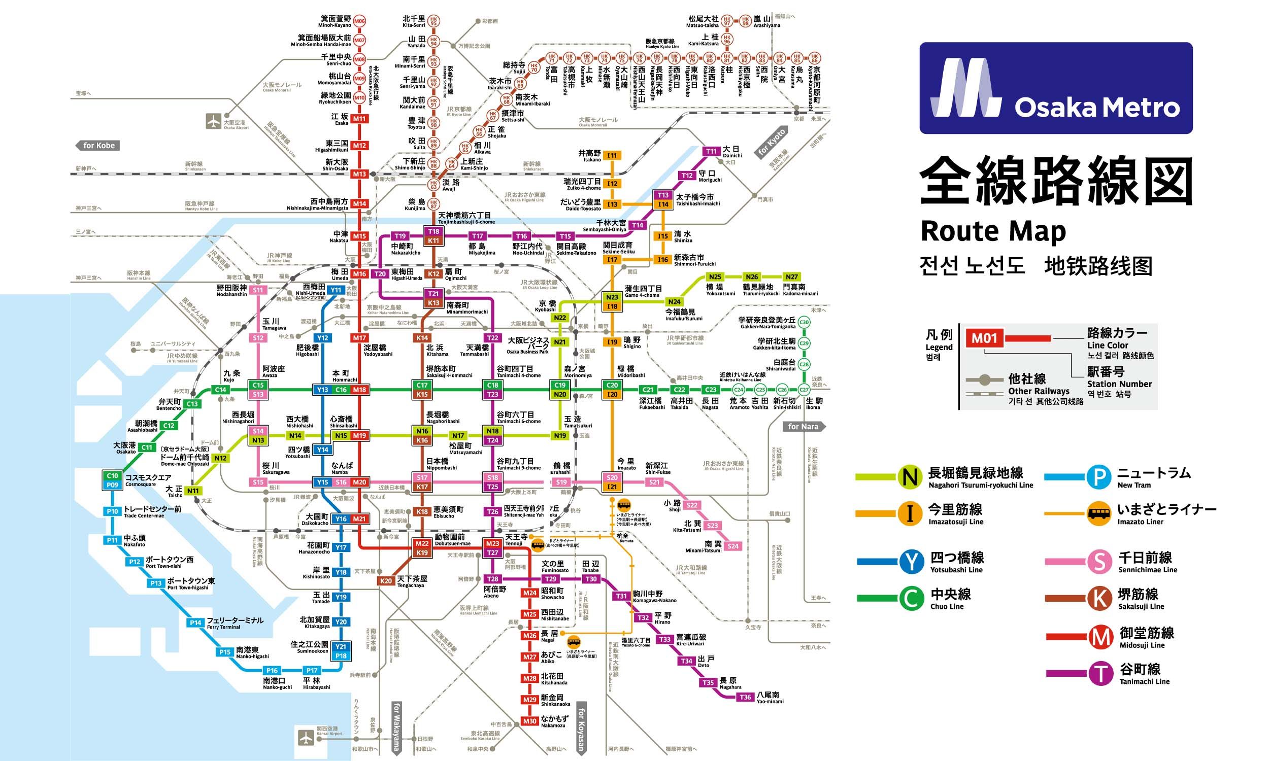
10 stations3 interchanges9.7 km~19 min
Board
Midōsuji Line
Platform 1
towards Nakamozu
Change to
Tanimachi Line
Platform 1
towards Yaominami
Change to
Chūō Line (Yumehanna)
Platform 1
towards Takaida
Change to
Imazatosuji Line
Platform 1
towards Imazato
- 1
-
2
Board the Midōsuji Line towards Nakamozu · from Platform 1
Ride 1 stop to Tennōji.Change lines here -
3
Board the Tanimachi Line towards Yaominami · from Platform 1
Ride 4 stops to Tanimachi Yonchōme.Change lines here -
4
Board the Chūō Line (Yumehanna) towards Takaida · from Platform 1
Ride 2 stops to Midoribashi.Change lines here -
5
Board the Imazatosuji Line towards Imazato · from Platform 1
Ride 2 stops to Gamō Yonchōme.
Origin
Dōbutsuen-mae (Shinsekai) Osaka
Gates / Exits
Gate No. 1
Osaka Tennoji Zoo / Tennoji Park (Art Museum) / Shinsekai and Tsutenkaku Tower / Ebisu-higashi 1- to 3-chome / Chausuyamacho
Gate No. 2
Osaka City University Hospital / Taishi 1- & 2-chome / Sanno 1- to 3-chome / City Bus
Gate No. 3
Kasumicho intersection NE corner
Gate No. 4
Kasumicho intersection SE corner / Osaka City University Hospital / Nishinari Police Station / Airin Kaikan (Rehabilitation consultation center) / Taishi 1- & 2-chome / Haginochaya 1- to 3-chome / Tengachaya-kita 1- & 2-chome / City Bus
Gate No. 5
Osaka Tennoji Zoo / Tennoji Park (Art Museum) / Shinsekai / Tsutenkaku Tower / Ebisu-higashi 1- to 3-chome / Chausuyamacho
Gate No. 6
Kasumicho intersection NW corner / JR Shin-Imamiya Sta. / Nankai Line / Hankai Line / Ebisu-nishi 2- & 3-chome / Airin Public Employment Security Office
Gate No. 8
Airin Kaikan (Rehabilitation consultation center) / Taishi 1- & 2-chome / Sanno 1- to 3-chome / Tengachaya-kita 1-chome
Gate No. 9
Nishinari Police Station / Haginochaya 1- to 3-chome / Tengachaya-kita 2-chome
Destination
Gamō Yonchōme Osaka
Gates / Exits
Gate No. 1
Gamo 4-chome intersection NW corner / Joto Ward Office / Joto Public Health and Welfare Center Annex / Joto Tax Office / Naniwahigashi Osaka Prefectural Tax Office / Joto Kaikan (Library) / Joto Children’s Center / Joto Police Station / Joto Fire Station / Welfare Center for the Aged / Joto Kumin Hall / NTT Joto / Japan Pension System Joto Office / Joto Pension Consultation Center / Chuo 1 to 3-chome
Gate No. 2
Gamo 4-chome intersection NE corner / Imafuku-nishi 3- & 5-chome / City Bus
Gate No. 3
Gamo 4-chome intersection SE corner / Imafuku-nishi 1-chome / City Bus
Gate No. 4
Gamo 4-chome intersection SW corner / Gamo 3- & 4-chome / City Bus
Gate No. 5
Osaka City Shinkin Bank / Osaka National Highway Office / Imafuku Children’s Center / Imafuku-nishi 1- to 4-chome / Imafuku-minami 1- & 2-chome / City Bus
Gate No. 6
National Route 1 east side / Imafuku-nishi 3- & 5-chome / City Bus
Gate No. 7
National Route 1 west side / Chuo 1 to 3-chome / Joto Ward Office / Joto Public Health and Welfare Center / Higashiosaka Hospital / Japan Pension Service Joto Office / Joto Library / City Bus
More routes from Dōbutsuen-mae (Shinsekai)
More routes from Gamō Yonchōme
Tanimachi Yonchōme