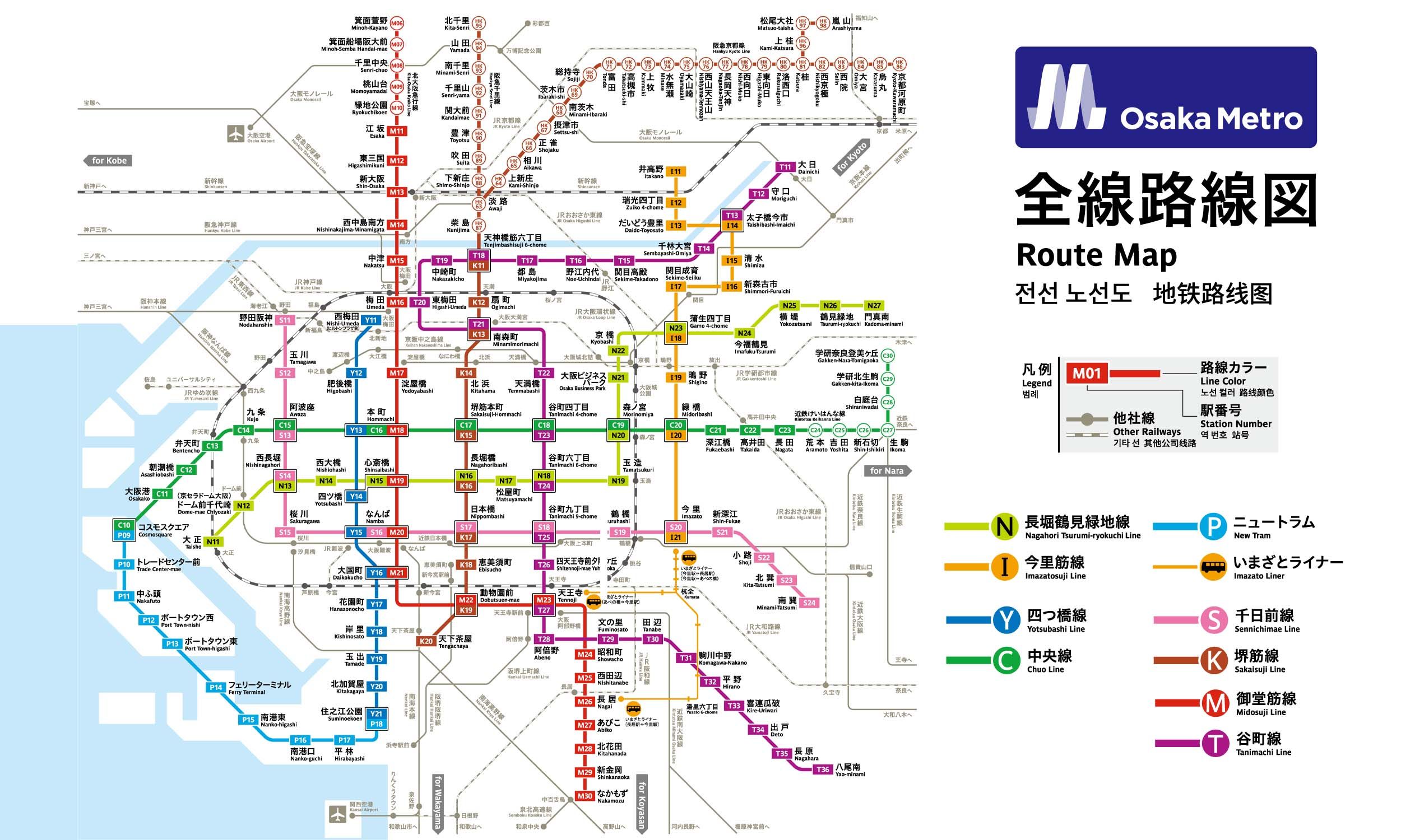
6 stations1 interchange5.7 km~11 min
Board
Chūō Line (Yumehanna)
Platform 1
towards Takaida
Change to
Sakaisuji Line
Platform 1
towards Tengachaya
- 1
-
2
Board the Chūō Line (Yumehanna) towards Takaida · from Platform 1
Ride 2 stops to Sakaisuji-Hommachi (Semba-higashi).Change lines here -
3
Board the Sakaisuji Line towards Tengachaya · from Platform 1
Ride 3 stops to Ōgimachi.
Origin
Awaza Osaka
Gates / Exits
Gate No. 1
Chuo-odori north side / Utsubo Park / Stadium / Nishihommachi 2- & 3-chome / Utsubohommachi 2- & 3-chome / Kyomachibori 2- & 3-chome / Edobori 2-chome
Gate No. 2
Chuo-odori south side / Itachibori 2- to 4-chome / Awaza 2-chome / Shimmachi 2- & 3-chome / City Bus
Gate No. 3
Chuo-odori north side / Consulate General of the People’s Republic of China / Osaka Judo Therapist Center / Nishihommachi 3-chome / Utsubohommachi 3-chome / Kyomachibori 3-chome
Gate No. 4
Awaza intersection SE corner / Jidoinn Children's Care Center / Osaka City Human Rights Promotion and Consultation Center / Nishi Sports Center / Itachibori 4-chome / Shimmachi 3-chome
Gate No. 5
Awaza intersection SW corner / Itachibori 5- & 6-chome / Shimmachi 4-chome / Honden 1-chome
Gate No. 6
Awaza intersection SW corner / Itachibori 5- & 6-chome / Shimmachi 4-chome / Honden 1-chome
Gate No. 7
Awaza intersection NW corner / Nishi Post Office / Nishi Tax Office / Nishi Police Station / Enokojima 2-chome / Kawaguchi 1- & 2-chome / Enokojima Art, Culture and Creative Center
Gate No. 8
Awaza intersection NW corner / Nishi Post Office / Nishi Tax Office / Nishi Police Station / Enokojima 2-chome / Kawaguchi 1- & 2-chome / Enokojima Art, Culture and Creative Center
Gate No. 9
Shin-Naniwasuji east side / Utsubo Park / Stadium / Consulate General of the People’s Republic of China / Osaka Judo Therapist Center / Osaka International Convention Center / Utsubohommachi 2- & 3-chome / Kyomachibori 2- & 3-chome / Edobori 2- & 3-chome / Nishihommachi 3-chome / City Bus
Gate No. 10
Shin-Naniwasuji west side / Tsunami and Storm Surge Station / Enokojima 1- & 2-chome / Kawaguchi 1- & 2-chome / City Bus
Destination
Ōgimachi Osaka
Gates / Exits
Gate No. 1
JR Osaka Loop Line Temma Sta. / Japan Pension Service Temma Office / Connecting walkway to Kinki Osaka Bank Bldg. / Tenjimbashi 4- & 5-chome / Nishikicho / Ikedacho / Temmabashi 3-chome
Gate No. 2-A
Ogimachi Park / Kitano Hospital / Ogimachi 1- & 2-chome / Kamiyamacho / Ogimachi Elementary School
Gate No. 2-B
Kita Ward Office / Kita Public Health and Welfare Center / Kita-ku Citizen’s Center / Ogimachi 1- & 2-chome / Yamazakicho / Naniwacho / Kurosakicho
Gate No. 3
Ogimachi intersection NE corner / Kita Environmental Business Center / Tenjimbashi 3- & 4-chome / Doshin 1- & 2-chome / Yorikimachi / Temmabashi 3-chome / Nishikicho
Gate No. 4
Ogimachi intersection NE corner / Kita Environmental Business Center / Tenjimbashi 3- & 4-chome / Doshin 1- & 2-chome / Yorikimachi / Temmabashi 3-chome / Nishikicho / City Bus
Gate No. 5
Ogimachi intersection SW corner / Waterworks Bureau / Kita Tax Office / Suehirocho / Minamiogimachi / Nozakicho / Nishitemma 5-chome / Minamimorimachi 2-chome / City Bus
Gate No. 6
Ogimachi Park / Ogimachi 1-chome / Kamiyamacho / City Bus
More routes from Awaza
Sakaisuji-Hommachi (Semba-higashi)
More routes from Ōgimachi
Sakaisuji-Hommachi (Semba-higashi)